Thomas Rogers House
Thomas Rogers House
| Address | 52 Mt. Pleasant St |
| Built | 1780 |
| Demolished | 1930 |
| Owners | Allan Bottomley (1887 - 1913) |
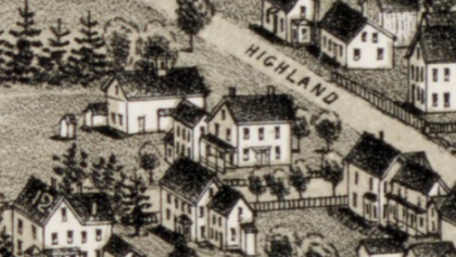
The Thomas Rogers House stood at the corner of High Street and Mt. Pleasant Street in North Billerica, where "the road leading from Billerica to Wamassett" (the Lowell road, now High Street) met the road from North Billerica to Tewksbury. For about a century and a half it was the farmhouse of a small Rogers homestead running from the corner west toward the Concord River. The house was razed in the early 1930s and replaced by the present house at 52 Mt. Pleasant Street.
Thomas Rogers (born 1714) was a son of John Rogers, who died intestate in 1736. His father's estate did not give him this land: the 1738 division left Thomas only a right in the new township of Nechewage, while the old Rogers homestead of 85 acres, which lay north of the Kidder farm, went to his brothers Zebediah and Samuel (probate 19464). How Thomas came by the corner farm south of the Kidders is not on record, but by 1781 it was "Thomas Rogers's land" when William Kidder gave his son Isaac the 63 acres to the north, running "westwardly by Thomas Rogers's land to Concord River." Isaac Kidder was also given his father's "new Barn to be moved off" onto his own land.
On January 26, 1784, Thomas Rogers and his wife Martha sold Isaac Kidder the corner itself: eight acres and 76 rods running 54 rods "upon the road leading from Billerica to Wamassett" and 20 rods on the road at its south corner, "with the Buildings." This is the earliest record of a house on the lot. Five weeks later Rogers made his will. He left his wife Martha the use of "all my Lands Buildings & Estate" for life, declared that "my Negro boy Cato shall be a free man," and gave "my homestead farm" after Martha's death to Timothy Crosby, Abigail the wife of Shemuel Griffin, and Cato in equal shares. He died that spring; the inventory valued "the Homestead and building thereon" at 272 pounds. Cato, about nineteen, chose Edward Pollard as his guardian, and in 1787, signing as "Cato Rogers," he gave a receipt for 40 pounds "in full of what my master Thomas Roger ... gave me in his last will."
In December 1789 Isaac Kidder sold John Rogers 71 acres, his father's 63 acres and the Rogers corner together, "with all the buildings thereon standing," from the Tewksbury road by Ebenezer French's orchard west past "the lower garden" to the river. John Rogers lived on the farm for almost forty years. On May 12, 1827 he gave his son Hermon Rogers the whole of it in two deeds of the same day, each for "one undivided half of all my real estate," in return for a bond to support himself and his wife and to pay Hermon's brother Cyrus $1,000; Hermon was not to take possession of the second half until his father's death. Hazen says Hermon (1792-1878) "lived in the east part of North Billerica, at the corner of the Lowell road," and the 1853 map shows "H. Rogers" here. In 1859 Hermon sold the farm land west of the house to Anthony Jones, reserving the corner "west of said Rogers present dwelling house," and on November 1, 1864, by then living in Amesbury, he sold "my former Homestead," about twenty acres "with the buildings thereon," to Frank D. Rogers of Belvidere, Illinois, for $2,500.
Frank D. Rogers sold the twenty acres in April 1866 to George P. Elliott, who had represented the district in the legislature in 1860-61; the 1875 map shows "Hon. G. P. Elliott." Elliott left the place by will to his widow, Ann D. Elliott, who in April 1887 sold "the George P. Elliott Homestead, containing twenty acres, more or less, with the buildings thereon" to Allan Bottomley for $6,000. Bottomley sold a strip on the west side to the Talbot Mills in 1889, and in September 1911 had O. M. Snell lay out five house lots along High Street north of the house (Plan Book 28, Plan 84). He sold Lot 1, "with the buildings thereon," to John E. Rowell in October 1911; this was the lot with the old barn. After Allan's death his widow Jane held the place, and in September 1921 her executors, Lillie and Frederick Bottomley, sold the house lot and Lots 2 to 4 to Forrest W. Todd for $5,000.
Todd mortgaged the property to Solomon S. A. Newton of Henniker, New Hampshire, and sold the very corner, 60 by 100 feet, to Maude D. Burnham. While Todd owned it the old house was taken down and replaced (accounts give 1925, 1930 and 1932). In 1936 Todd gave the property, still "with the buildings thereon," to Newton, his mortgagee, and in 1937 Newton sold it to Edward W. and Ruth S. Cousins. The Cousinses bought the Burnham corner at a tax sale in 1940 and settled the title with Mrs. Burnham (by then Maude D. Bangs) in 1950. In July 1952 they had E. P. Simpson survey the land (Plan Book 82, Plan 27A), which shows a "Dwelling & Gar." on the corner, and sold it in two lots to private owners: the corner lot with the house, now 52 Mt. Pleasant Street, and a 40,262 square foot lot to the west. The corner lot has since passed through private owners.
The 1736 Rogers estate gave Thomas no Billerica land, Isaac Kidder's 1781 land lay north of Thomas Rogers, and the house returned to the Rogers family in 1789 as part of a 71-acre farm bought by John Rogers, Hermon's father. The 1921 sale was made by the executors of Jane Bottomley, and Forrest Todd's 1936 deed was a surrender to his mortgagee rather than an ordinary sale.
References
Title References
| Date | Type | Grantor | Grantee | Summary | Recorded |
|---|---|---|---|---|---|
| 1736 | Administration and Division | Estate of John Rogers of Billerica (d. 1736, intestate) | Widow Abigail; sons Thomas, Timothy, Zebediah and Samuel Rogers | 1736-38 estate of John Rogers: Thomas Rogers inherits no Billerica land | Probate #19464 |
Administration granted to the widow Abigail Aug. 15, 1736. The inventory (Jan. 5, 1737) lists "the Homestead containing about eighty five acres ... bounded easterly by the highway that leads to Waymesset, southerly on land of William Kidder, westerly on Concord River, north by the land of John Leavestone and an old Mansion house thereon standing and a barn," a 48-acre lot by John Leavestone, and two rights in the new township of Nechewage. Distribution Feb. 9, 1738: to Thomas Rogers only "one lot or right in a new township called Nechewage," the right of Thomas Farmer No. 57; to Timothy the other Nechewage lot; and to Zebediah and Samuel "the remainder of lands and buildings in Billerica and Tewksbury besides the widows thirds," confirmed in 1746. The Rogers homestead of 1737 lay north of the Kidders, so Thomas Rogers's later corner farm south of the Kidders did not come to him from his father.
Title from:
Title passed to:
|
|||||
| November 4, 1786 | Deed | William Kidder of Billerica, gentleman | His son Isaac Kidder of Billerica, yeoman | 1781 Kidder land north of Thomas Rogers (abutter) | 81/643 (South) |
For love and affection and 266 pounds 13s 4d, five parcels, chiefly 63 acres "beginning at the southeasterly corner at a stake & stones by the highway leading from said Billerica to Wamassett, thence running westwardly by Thomas Rogers's land to Concord River," by the river to a pine marked K.F., by an old rail fence and a black oak "near the line between the Carrier & the Rogers's lots so called," easterly to a stone wall "near the Barn" and so to the highway; also half the Mill Meadow, the Trull lot and part of the Shed lot, and half his Tewksbury land, "and also my new Barn to be moved off from the land upon which it now stands." No dwelling house is named: this is the land north of Thomas Rogers. Signed Dec. 27, 1781; recorded Nov. 4, 1786. Billerica town book 7, pages 341-343.
Title passed to:
|
|||||
| 1784 | Will | Estate of Thomas Rogers of Billerica, yeoman | Widow Martha Rogers for life; then Timothy Crosby, Abigail wife of Shemuel Griffin, and Cato | 1784 will of Thomas Rogers (homestead next to the corner lot) | Probate #19490 |
Will dated March 3, 1784: to "Martha my beloved wife the full use ... of all my Lands Buildings & Estate" for life; "my Negro boy Cato shall be a free man"; after the widow's death "my homestead farm laying in Billerica" and the rest of the estate to Timothy Crosby, Abigail wife of Shemuel Griffin, and Cato equally; the executors may sell "my Meadow of about four acres called Broad meadow" for debts. Proved June 2, 1784 (Shemuel Griffin executor). Inventory Sept. 8, 1784: "the Homestead and building thereon" 272 pounds 4s, a piece of land in Broad Meadow 36 pounds. The homestead was the land west of the corner lot Rogers had sold Isaac Kidder in January.
Title passed to:
Related:
|
|||||
| 1784 | Guardianship | Cato, "late the Servant of Thomas Rogers" (about 19) | Edward Pollard of Billerica, cordwainer, guardian | 1784-88 Cato Rogers guardianship and legacy | Probate #19441 |
Cato, freed by Thomas Rogers's will, chose Edward Pollard as guardian June 1, 1784 ("about nineteen years of age"). On April 9, 1787 "Cato Rogers" gave a receipt for 40 pounds 11s 8d "in full of what my master Thomas Roger late of Billerica deceased gave me in his last will," showing that his third of the Rogers homestead had been paid out in money by then; discharge allowed April 2, 1788.
Related:
|
|||||
| January 5, 1790 | Deed | Thomas Rogers of Billerica, yeoman; Martha Rogers his wife releasing dower | Isaac Kidder of Billerica, yeoman | 1784 Thomas Rogers sells the corner lot with buildings to Isaac Kidder | 101/379 (South) |
For 40 pounds 8s 8d, "a certain tract of land ... containing Eight acres & seventy six rods," beginning at the southeasterly corner and running northerly "upon the road leading from Billerica to Wamassett" (the Lowell road, now High Street) 54 rods, westerly by Isaac Kidder 28 7/10 rods, southerly "by my own land" 58 rods to the road (now Mt. Pleasant Street), and by that road 20 rods to the corner, "with the Buildings & appurtenances." This corner lot is the site of the Thomas Rogers House. Signed Jan. 26, 1784 (witnesses William Kidder, Samuel Foster), five weeks before Rogers made his will; acknowledged Jan. 28, 1784; recorded Jan. 5, 1790. Billerica town book 8, pages 201-202.
Title passed to:
Related:
|
|||||
| February 23, 1798 | Deed | Isaac Kidder of Billerica, yeoman; Sarah his wife and Sarah Kidder, widow, releasing dower | John Rogers of Billerica, yeoman | 1789 Kidder to John Rogers, 71 acres with buildings | 128/13 (South) |
For 190 pounds, "a certain tract or parcel of land ... containing by estimation seventy one acres" (the 63 acres from his father plus the 8 acres from Thomas Rogers), beginning "at the Northeasterly angle by the road or highway leading from Billerica to Tewksbury at the wall on the South side of Ebenezer French's Orchard," west along the wall past "the lower garden" to the Concord River, up the river to Timothy Sprague, by Sprague and Thomas Richardson to a road, and by the roads back to the first bounds, "with all the buildings thereon standing"; also ten acres on the other side of the road by Samuel Trull. The widow Sarah Kidder released her dower "in consequence of my sons giving me a lease of one third part of his land & buildings in Townshend." Signed Dec. 15, 1789; recorded Feb. 23, 1798. Billerica town book 9, pages 339-341.
Title from:
Title passed to:
|
|||||
| February 10, 1846 | Deed | John Rogers of Billerica, yeoman | His son Hermon Rogers of Billerica, yeoman | 1827 John Rogers gives Hermon the other half, possession at his death | 474/379 (South) |
"In consideration of a bond for the support of myself and wife and for the payment of one thousand dollars to my son Cyrus Rogers by my son Hermon Rogers ... and for the love I bear him," John Rogers conveys "one undivided half of all my real estate wheresoever the same may be situated," "I having conveyed to the said Hermon the other half by a deed of this date but he the said Hermon is not to come into the actual possession or improvement thereof until my decease and then not untill he has paid to the said Cyrus the sum of one thousand dollars." With the companion deed (Book 474, Page 380) this put the whole of the 1789 Kidder farm, house included, in Hermon's hands. Signed May 12, 1827 before Joseph Locke; recorded Feb. 10, 1846. Billerica town book 20, pages 53-54.
Title from:
Title passed to:
Related:
|
|||||
| February 10, 1846 | Deed | John Rogers | Hermon Rogers | 1827 John Rogers gives son Hermon half his real estate | 474/380 (South) |
John Rogers of Billerica, yeoman, "in consideration of love and affection and also of past services rendered by my son Hermon Rogers," conveys "one undivided half of all my real estate wherever the same is situated and however bounded or described." Signed May 12, 1827 before Joseph Locke; not recorded until Feb. 10, 1846, with Franklin B. Chapman's deed to Hermon of ten acres by Morey and Stevens, the heirs of William Bowers and C. W. French (Book 474 Page 381). Hazen: Hermon Rogers (1792-1878) "lived in the east part of North Billerica, at the corner of the Lowell road." The descent of the Rogers land from John Rogers Jr., killed here in 1695, to this John Rogers has not been traced. Billerica town book 18, pages 71-72.
Title from:
Title passed to:
|
|||||
| October 10, 1859 | Deed | Hermon Rogers and Hannah Rogers | Anthony Jones | 1859 Hermon sells the farm west of "said Rogers present dwelling house" | 21/331 |
For $4,700, a lot "on the west side of the old road which leads from Billerica by said Rogers dwelling house to Lowell," from the corner of "the Collins farm" (now Mrs. Pinnock's) westerly across the Boston and Lowell Railroad location, by Mrs. McGlone to the Concord River, up the river to J. R. Faulkner, by the Faulkners and "land taken from John Rogers and myself" for the railroad to the road from North Billerica Mills to Tewksbury, around a lot of the Talbots, and easterly "to the first wall west of said Rogers present dwelling house" and the Sprague lot; subject to the railroad location and flowage rights sold to Oliver M. Whipple. Also a second lot on the easterly side of the Lowell and Billerica road, from the corner of Mary Pasho's land "near her dwelling," by C. W. French and Ebenezer French to the Collins farm. Signed Oct. 8, 1859. Jones mortgaged it back to Hermon (Book 21 Page 334), discharged Feb. 29, 1860 (Book 23 Page 68).
Title passed to:
Related:
|
|||||
| November 11, 1864 | Warranty Deed | Hermon Rogers of Amesbury; Hannah Rogers his wife releasing dower | Frank D. Rogers of Belvidere, Boone County, Illinois | 1864 Hermon Rogers sells "my former Homestead" to Frank D. Rogers | 38/250 |
For $2,500, "a certain tract of land situate in North Billerica ... containing about twenty acres more or less with the buildings thereon," beginning at the southwest corner "at the road leading from North Billerica to Tewksbury at land of Mrs. L. Talbot," north by Talbot and L. Rogers to Martin Conway, east by Conway "to the road leading from Billerica to Lowell," and back along both roads, "known as my former Homestead in Billerica"; also five acres in Broad Meadow, fifteen acres of woodland called the Cold Brook lot (by Dudley Foster, Micajah Rogers and the Boston and Lowell Railroad), and ten acres in East Billerica bought of Franklin B. Chapman in 1846 (Book 474, Page 381). Signed Nov. 1, 1864; recorded Nov. 11, 1864 (Book 38, pages 250-251).
Title from:
Title passed to:
|
|||||
| May 1, 1866 | Deed | Frank D. Rogers of Belvidere, Illinois; Mary E. Rogers his wife releasing dower | George P. Elliott of Billerica | 1866 Frank D. Rogers to George P. Elliott | 49/109 |
For two thousand ... hundred and fifty dollars (the scan is faint), "a certain tract of land located at North Billerica ... containing twenty acres more or less with the buildings thereon," with the same bounds as the 1864 deed (Tewksbury road, Talbot, Martin Conway, road from Billerica to Lowell), and the five acres in Broad Meadow; "being the same conveyed to me in deed of Hermon Rogers dated November 1st 1864 ... Book 38 Page 250." Dated April 1866 (April 25 per the 1887 deed), acknowledged April 30, 1866 before Dudley Foster; recorded May 1866 (Book 49, pages 109-111; exact recording day illegible, entered as May 1).
Title from:
Title passed to:
|
|||||
| April 22, 1887 | Deed | Ann D. Elliott of Billerica, widow | Allan Bottomley of Billerica | 1887 Elliott homestead, 20 acres with buildings, to Bottomley | 187/154 |
For $6,000, "A certain tract of land located at North Billerica and known as the George P. Elliott Homestead, containing twenty acres, more or less, with the buildings thereon," bounded from the road from North Billerica to Tewksbury (Mt. Pleasant St) at land of Mrs. F. S. Clark, north by Clark and the heirs of Thomas Talbot to Martin Conway, east by Conway to the road from Billerica to Lowell (High St), and back along both roads. "Being premises conveyed to George P. Elliott by Frank D. Rogers by deed dated April 25th 1866 ... Book 49, Page 109, and devised to me by the said George P. Elliott by his last will." Signed April 14, 1887 before Dudley Foster; recorded April 22, 1887 (Book 187, pages 154-155).
Title from:
Title passed to:
|
|||||
| August 2, 1889 | Deed | Allan Bottomley of Billerica; Jane Bottomley his wife releasing dower | The Talbot Mills of Billerica | 1889 strip on the west side sold to the Talbot Mills | 208/155 |
For $420, "a parcel of land situate in that part of Billerica called North Billerica containing seven tenths of an acre," a strip 66 feet wide running north about 462 feet from "the road leading from North Billerica to Tewksbury" (Mt. Pleasant Street) along land of the Talbot Mills to a stone wall: "a portion of the premises conveyed to Allan Bottomley by Ann D. Elliot" in 1887 (Book 187, Page 154). This is the west line of the later house lot (Talbot Mills Lot 1 on the 1952 plan). Signed July 31, 1889; recorded Aug. 2, 1889.
Title from:
|
|||||
| November 17, 1911 | Deed | Allan Bottomley of Billerica; Jane Bottomley releasing dower | John E. Rowell of Billerica | 1911 Lot 1 (barn lot) on the Bottomley plan sold to John E. Rowell | 479/338 |
For one dollar and other consideration, "a certain lot of land together with the buildings thereon" on the westerly side of High Street, "being lot No. 1 on a Plan of Land in North Billerica Mass. belonging to Allan Bottomley, Sept. 1911, surveyed by O. M. Snell C.E." (Plan Book 28, Plan 84), 100 by 60 feet, 5,994.60 square feet, "a part of the premises conveyed to me by Ann D. Elliot" in 1887. This lot, north of the house, held the old barn; Lots 2 to 5 along High Street were laid out on the same plan. Signed Oct. 31, 1911; recorded Nov. 17, 1911.
Title from:
Title passed to:
|
|||||
| September 23, 1921 | Executors' Deed | Lillie Bottomley of Billerica and Frederick Bottomley of Haverhill, executors of the will of Jane Bottomley | Forrest W. Todd of Billerica | 1921 Bottomley executors to Todd, house lot with buildings | 650/1 |
Under a Probate Court license of Sept. 15, 1921, for $5,000, "two certain parcels of land with the buildings thereon" in North Billerica: (1) the corner lot on the north side of Mount Pleasant Street, "formerly called the road from North Billerica to Tewksbury," and the west side of High Street, "formerly called the road from North Billerica to Lowell," running about 235 feet north along the lot Allan Bottomley sold the Talbot Mills in 1889 (Book 208, Page 155) and bounded by lots sold to Mary R. Potter and John E. Rowell (1911, Book 479, Page 338); (2) Lots 2, 3 and 4 (14,986.5 sq. ft.) on the west side of High Street on the 1911 Snell plan of Allan Bottomley's land (Plan Book 28, Plan 84). Title: part of the premises conveyed by Ann D. Elliott to Allan Bottomley, "deceased husband of said Jane Bottomley," April 14, 1887 (Book 187, Page 154). Signed Sept. 17, 1921 (Book 650, pages 1-3).
Title from:
Title passed to:
Related:
|
|||||
| September 23, 1921 | Mortgage | Forrest W. Todd of Billerica; Etta A. Todd releasing dower | Solomon S. A. Newton of Henniker, N.H. | 1921 Todd mortgage to Newton | 650/3 |
Mortgage "with mortgage covenants" to secure $3,700 in one year at five per cent, on the same "two certain parcels of land with the buildings thereon" at Mount Pleasant and High Streets, "being the same premises conveyed to me by Lillie Bottomley et al., Executors" by deed of Sept. 17, 1921, recorded simultaneously. Signed and recorded Sept. 23, 1921 (Book 650, pages 3-4). Newton, the mortgagee, took the property from Todd in 1936.
Related:
|
|||||
| November 14, 1921 | Quitclaim | Forrest W. Todd of Billerica; Etta A. Todd releasing dower | Maude D. Burnham of Billerica | 1921 corner of the homestead sold to Maude D. Burnham | 652/63 |
"For consideration paid," a lot "on the westerly side of High Street and the northerly side of Pleasant Street," beginning at a stake on High Street sixty feet south of a drill hole in the stone wall at the corner of John R. Sutcliffe (Lot 1 on the 1911 Snell plan, Plan Book 28, Plan 84), west 60 feet, south about 100 feet to Pleasant Street, and back by Pleasant and High Streets: the very corner of the old Rogers homestead. "Being a part of the same premises conveyed to me by Lillie Bottomley and Frederick Bottomley, Executors" (Book 650, Page 1). Signed Oct. 25, 1921; recorded Nov. 14, 1921 (Book 652, pages 63-64). The Town took this lot for Burnham's unpaid taxes in 1934.
Title from:
Title passed to:
|
|||||
| May 18, 1936 | Quitclaim | Forrest W. Todd of Billerica; Etta A. Todd releasing dower | Solomon S. A. Newton of Henniker, N.H. | 1936 Todd surrenders the property to mortgagee Newton | 881/207 |
Quitclaim, "for consideration paid," of "two certain parcels of land with the buildings thereon" in North Billerica on the westerly side of High Street, "formerly called the road from North Billerica to Lowell," and the northerly side of Mt. Pleasant Street, "being the same premises to me conveyed by Lillie Bottomley et al, executors" Sept. 17, 1921 (Book 650, Page 1), "excepting however so much of said premises as was conveyed by me to Maude D. Burnham" in October 1921 (Book 652), and "subject to a certain mortgage to said grantee" (the 1921 mortgage) and to unpaid taxes and tax titles. In effect Todd surrendered the property, with the new house he had built about 1930-32, to his mortgagee. Dated April 13, 1936; recorded May 18, 1936.
Title from:
Title passed to:
Related:
|
|||||
| May 28, 1937 | Quitclaim | Solomon Q. A. Newton of Henniker, N.H., unmarried | Edward W. Cousins and Ruth S. Cousins of Billerica | 1937 Newton to Edward W. and Ruth S. Cousins | 899/181 |
"For consideration paid," with quitclaim covenants, "Two certain parcels of land with the buildings thereon" in North Billerica on the westerly side of High Street, "formerly called the road from North Billerica to Lowell," and the northerly side of Pleasant Street, "formerly known as Mt. Pleasant Street," "being the same premises to me conveyed by Forrest W. Todd" (Book 881, Page 207), subject to the 1937 taxes. Signed May 24, 1937 (the deed calls Todd's deed April 30, 1936); recorded May 28, 1937 (Book 899, pages 181-182).
Title from:
|
|||||
| October 3, 1950 | Quitclaim | Maude D. Bangs, formerly Maude D. Burnham, of Leominster | Edward W. Cousins and Ruth S. Cousins of Billerica | 1950 title clearing; 1952 division of the lot | 1153/98 |
To clear the tax title, the Cousinses first quitclaimed to Mrs. Bangs whatever they had under the 1940 treasurer's deed (Book 1153, Page 97), and she, the same day, quitclaimed to them the 60 by 100 foot corner "on the westerly side of High Street and the northerly side of Mt. Pleasant Street," "Being the same premises conveyed to me, under the name of Maude D. Burnham, by Forrest W. Todd" (Book 652, Page 63). Signed Sept. 25, 1950; recorded Oct. 3, 1950. In July 1952 the Cousinses, then of Norwood, had the land surveyed (E. P. Simpson, Plan Book 82, Plan 27A) and sold it in two lots to private owners: the corner lot "with the buildings thereon," which is 52 Mt. Pleasant Street (Book 1201, Page 269; resold in 1988), and a 40,262 square foot lot to the west. Later owners are private.
Title from:
Related:
|
|||||
Recorded is Book/Page at the Middlesex North Registry of Deeds unless noted; Probate # is a Middlesex probate case, Ctf a Land Court certificate of title.